Free and easy elevation drawing software
Easily make an elevation plan for your house, office, workshop, cabin, apartment, condo, and other buildings. No download! Try this online drawing software right away. Start making a elevation blueprint now!

Why Use EdrawMax Elevation Plan Maker?
Drag and drop elevation and floor plan symbols like roof, garage, chimneys, trees, lights, doors, windows, pipes, and more. Add dimensions like height, width, and length to the plan. Highlight important elements with comments and annotations. Adjust the sizes and colors of each symbol in bulk or separately.

Save time and effort! Make inquiries using Edraw AI and leverage the smart drawing function to produce blueprints and 3D inspirations for your commercial projects. Enable AI Presentation to generate a fully-fledged slideshow and show it to your clients for creative inspiration.

Choose from a wide range of professional elevation plans created and shared by professional designers. From construction plans to residential buildings, bathroom elevations, and kitchen projects, you can find what you need from 28,000+ templates on EdrawMax Library.

Teamwork is seamless with EdrawMax. It allows designing from multiple devices, such as Linux, Windows, iOS, Android, and MacOS. EdrawMax also supports a Personal Cloud space for virtual teams. Log into EdrawMax Online and collaborate with your clients and contractors.

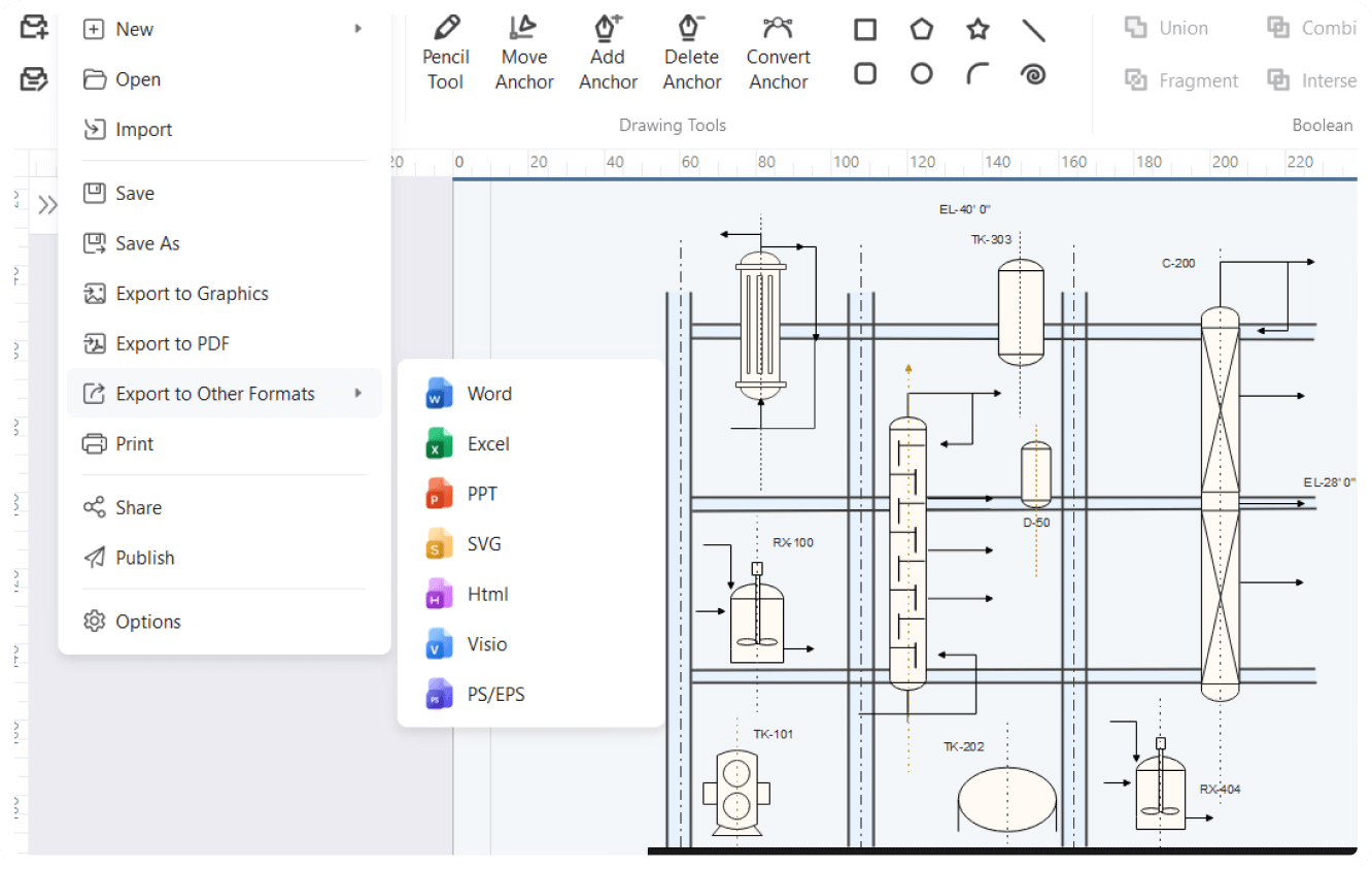
How to make a elevation plans on EdrawMax?


What our users say
More floor Plan Tools
Discover more AI-powered diagram makers to boost your productivity.
FAQs about elevation plan maker
-
What is an elevation drawing in architecture?An elevation drawing is a two-dimensional orthographic projection that shows one side of a building or object. Unlike a floor plan, which looks down from above, an elevation provides a straight-on view. It illustrates height, width, materials, and exterior features like windows and doors, helping builders visualize the finished appearance.
-
What are the primary types of elevation drawings?There are four primary types: front, rear, left, and right elevations. These are often labeled based on compass directions, such as North or South elevation. Interior elevations are also common, showing specific walls inside a room to detail cabinetry, tiling, or decorative features that floor plans cannot fully describe.
-
What common symbols are used in elevation drawings?You will typically see level markers indicating floor heights, ceiling lines, and roof peaks. Symbols for window types, door swings, and material callouts like brick or siding are also standard. Additionally, dimensions show the vertical distance between elements, and "grade lines" indicate where the building meets the ground surface.
-
What scale is typically used for elevation drawings?Most residential elevation drawings use a scale of 1/4 inch equals 1 foot or 1/8 inch equals 1 foot. For larger commercial projects, the scale might be smaller. Using a consistent scale is vital as it allows contractors to accurately measure heights and proportions directly from the printed paper.
-
How does an elevation drawing differ from a floor plan?While a floor plan is a horizontal "top-down" slice showing room layouts and walls, an elevation drawing is a vertical "side-on" view. Floor plans focus on horizontal space and movement, whereas elevations focus on vertical heights, exterior cladding, and the visual relationship between different levels of the building’s facade.
-
What is an interior elevation drawing used for?Interior elevations focus on specific vertical surfaces inside a building. They are commonly used for kitchens and bathrooms to show the exact placement of cabinets, mirrors, and plumbing fixtures. These drawings provide the detail necessary for installers to understand the height of backsplashes and the arrangement of built-in furniture.
-
Is an elevation drawing the same as a perspective drawing?No, they are different. A perspective drawing uses vanishing points to create a realistic 3D sense of depth. In contrast, an elevation is a 2D orthographic projection where all lines remain parallel. Elevations are not "realistic" views but are technical tools used for precise measurement and construction of the building.
Stop drawing. Start describing.
AI diagramming isn't just text-to-diagram.
AI now understands any input, fetches live data, adapts through dialogue, and works everywhere.
Free elevation plans templates from EdrawMax